When it’s time to make decisions, it helps to have all the right information in one place.
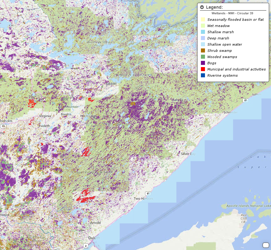
A new online platform created at the University of Minnesota’s Natural Resources Research Institute (NRRI) will help communities, industries, NGOs, and local government agencies in northeast Minnesota gain a big-picture view of their region to inform the way they plan projects and make decisions. The Minnesota Natural Resource Atlas, which officially launched in December and is free to the public, allows users to explore myriad data sets related to the distribution and use of natural resources within a single map-based interface.
The project started about two years ago, using a portion of $2.6 million in state funding to NRRI at U of M Duluth. Lucinda Johnson, Ph.D., NRRI associate director and initiative director for water, leads the project, which was developed by an interdisciplinary team of researchers that span Duluth’s NRRI, the College of Food, Agricultural and Natural Resource Sciences on the Twin Cities campus, and the U’s Minnesota Sea Grant program. The team consulted state agencies to make sure the tool is relevant to their needs.
“Many comprehensive (and expensive) tools exist to display maps and their underlying spatial data, but NGOs, conservation groups, tribal entities, legislators, and economic development organizations can lack the technical capacity to take full advantage of them,” Johnson said. “The Natural Resource Atlas is meant to fill this need by providing mapped data to local decision makers in a useful form that does not require an enormous investment in software and training.”
When it comes to the data itself, the platform has no shortage of it. The research team drew from vetted sources to create 270 different data layers, ranging from mineral resources and infrastructure to social and economic information, that the user can toggle on or off individually, based on what they want to see. The information comes from academic institutions, federal, state and local agencies, nongovernmental organizations, and the NRRI.
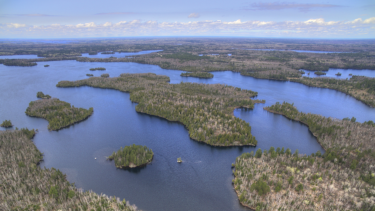
There are a number of ways to make use of all these data. For example, it could help to reveal development opportunities in the mineral, forestry, water, or tourism industries. The data could also identify areas that should be considered for ecological restoration or enhanced protection, evaluate areas for economic development, or plan easements through land for specific purposes. The atlas even includes trails and aerial imagery that the general public can use to plan out hikes and see changes in elevation.
In all cases, the platform provides scientifically sound data in an easy-to-view and access format that can help guide decision-making in the early stages, said Will Bartsch, senior research scientist with NRRI and project manager for the Minnesota Natural Resource Atlas.
When creating the tool, the research team first identified organizations that might benefit most from it—namely, those that make decisions involving or impacting natural resources, but don’t have the capabilities or resources to gather the data themselves or don't have the technical capacity to use complicated mapping platforms. Among these users are economic development groups, environmental organizations, the state legislature, and local governments.
“We engaged target end users early and developed it for their needs,” Bartsch said. “It really is about making information that already exists accessible to everybody.”
The researchers conducted early testing of the platform in August and September and received positive responses from every group that gave it a try. Now that the full platform has launched for general use, they plan to maintain and update the data in the northeast region while exploring the possibility of expanding the platform across the state.
“Our hope is that this resource will help make maps and spatial data come alive and result in better communication and decision making,” Johnson said.
Explore the Minnesota Natural Resource Atlas.