The only center of its kind in the United States, UMN’s Polar Geospatial Center (PGC) provides geospatial, remote sensing, and mapping support to polar researchers and logistics, effort that is greatly aided by the work of User Services Manager Cole Kelleher. Kelleher was working toward his Master of Geographic Information Science (GIS) when he became a graduate research assistant with PGC in 2011 and has been with the center since.
Founded in 2007 by Paul Morin, PGC was originally known as the Antarctic Geospatial Information Center and focused on Antarctic mapping. After four years it became clear that the work the center was doing could benefit researchers in both the Antarctic and the Arctic, and the name changed to the Polar Geospatial Center to reflect that. In addition to mapping, the center also began incorporating high-resolution commercial satellite imagery, largely due to the University’s strong GIS program and expertise, and is now the largest single consumer of commercial satellite imagery outside of the National Geospatial Intelligence Agency.
“PGC is funded by the National Science Foundation and NASA and works with the National Geospatial Intelligence Agency to gain access to high resolution commercial satellite imagery, which we archive,” said Kelleher. “We now have almost 17 petabytes of imagery.” For context, some estimates say a petabyte is equal to 20 million tall filing cabinets.
PGC uses this imagery to see what’s going on in the polar regions at a higher resolution than ever before and provide specialized data products and maps that the scientific community and logistics community can use.
One of the center’s more impactful products is the ArcticDEM, which depicts the topographic elevation of the entire Arctic at two meter resolution, a resolution that’s higher than some current maps of the continental United States. This initiative was so significant that it was actually announced by President Obama when the US was chair of the Arctic Council. PGC then did the same thing for the Antarctic, making it the first elevation model of that resolution made for an entire continent.
These models are changing the way the international research community can work together and see polar changes that are happening, such as glacier volume changes or permafrost thaw. PGC also creates image mosaics that enable researchers to get a basic understanding of the landscape. Both the models and image mosaics are helpful in giving researchers a starting point for decision making of where to conduct future research.
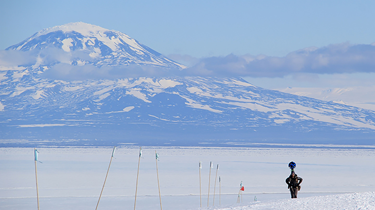
PGC also does traditional mapping and maintains a historical map archive, which can be inserted into GIS software and offer researchers new layers of information. PGC also sends staff to McMurdo Station in Antarctica every year. Kelleher himself contributed to modern mapping of Antarctica in a major way as the first person to gather imagery for Google Maps’ Street View feature in 2012 and 2013.
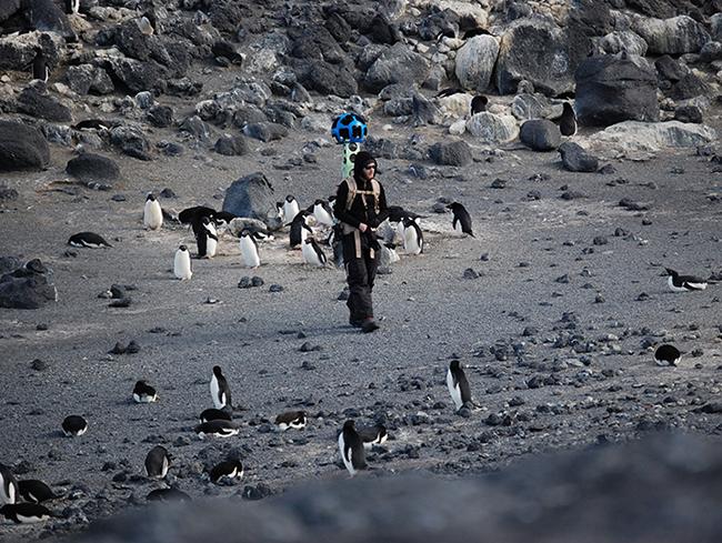
“I was able to carry a Google Street View backpack out in the field, specifically in the McMurdo Dry Valleys, which is the largest ice-free region on the continent and a very unique place in terms of geology, ecology, and microbiology,” said Kelleher. “People often think of Antarctica as this far away place, so I think it’s important to bring Antarctica to people, especially in light of climate change and all the science being conducted down there.”
In working with maps, PGC has inevitably gone into the realm of place names, especially in the Antarctic where there is no overarching naming authority.
“Naming features is very interesting and each country has its own gazetteer of names,” explained Kelleher. “But when we’re doing high-precision mapping, it’s important to have accurate names, especially in a place like Antarctica where you have emergency situations and search and rescue missions. A common understanding of what things are named is critical when you’re working in an area with limited resources and may need to rely on international partners.”
Kelleher has worked with the United States Geological Survey and its Advisory Committee on Antarctic Names to improve the accuracy of over 11,000 US recognized Antarctic names to date and now serves as the US representative to the Standing Committee on Antarctic Geographic Information (SCAGI) which is part of the Scientific Committee on Antarctic Research (SCAR). SCAGI is an international committee composed of representatives from any country currently doing geospatial work in Antarctica. The committee talks about how to work together, share data and resources, and develop practices and naming policies, which led to the release of principles and procedures for Antarctic naming in 2021. Kelleher also contributes as the SCAR liaison to the United Nations Group of Experts on Geographic Names.

“Many Antarctic names are historical in nature,” said Kelleher. “That’s why the principles and procedures we put together are so important because going forward the intent is that there won’t be any new contested names going forward. We’ll all have a common understanding.”
PGC’s work is ongoing. Due to their regular data collection, they’re often generating new elevation models and releasing new products. The center has also worked hard on preserving historical data, including an archive of aerial photography of the polar regions.
“There’s no group in the US doing what we do or at the breadth of what we do in terms of mapping and using high resolution, commercial satellite imagery. And on top of that, we make products that are ultimately a primary resource to the polar science and logistics community. We’re now collaborating with supercomputers and have moved into application development to further advance the use of our products and services by the polar community.”
When Kelleher started at PGC, he knew very little about the polar regions. Now he’s been to both. When asked if he has a favorite he says, “they’re so different. The Antarctic is the only continent that’s set aside for science at the international level, which is a pretty big deal. But, on the other hand, the Arctic is super interesting because people live there and they are on the front lines of climate change impacts. I also think it’s important to remember that, because of Alaska, the US is an Arctic nation.”